Application of GIS software in mining
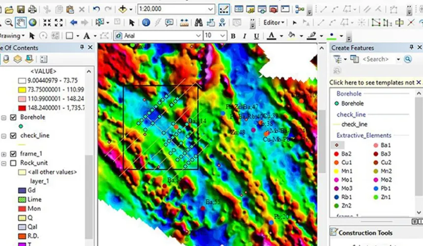
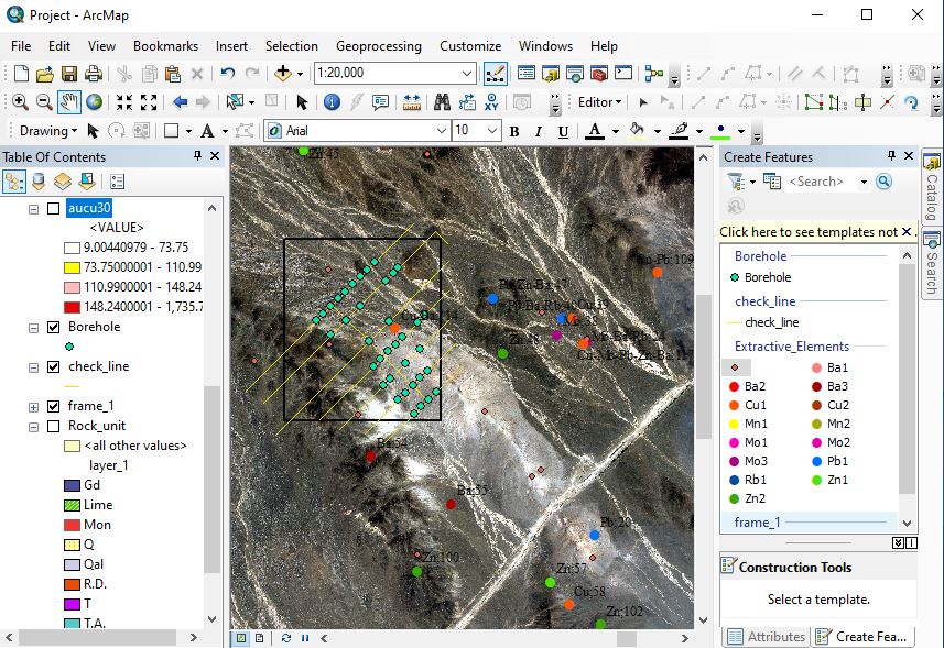
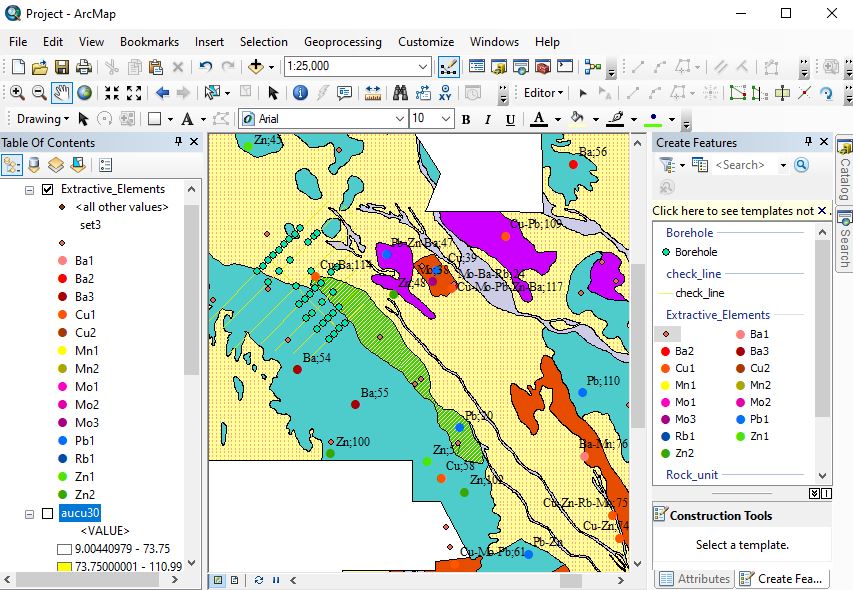
GIS is widely used in the processing of mineral information and their integration, which leads to time and costs savings from exploration to processing of minerals and is one of the advantages of this software. This software (GIS) is able to display all exploration and geological data of the mine as a spatial database.
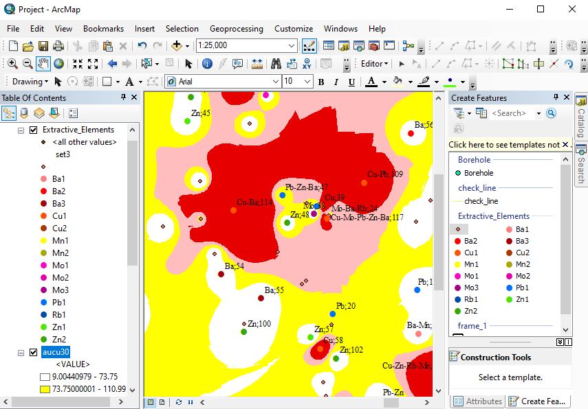
The data includes geological information, topography, borehole information, telemetry, multispectral satellite images, geochemical samples, etc. The more accurate this information is, the better the software will perform. The data is then interpreted and then structural analysis is performed.
The process of performing all other exploratory activities such as lithology, tectonics, geophysics and geochemistry is facilitated and accelerated, and finally these data are combined with each other and exploratory anomalies are determined, which allows the three-dimensional model to reduce exploration drilling costs. Save different output formats for use in other mining software. Gis can be mentioned as a powerful software for determining the extraction process in unstable geological conditions, in order to determine the passage of people, ventilation wells and cargo transportation..
Other applications include estimating mining company assets to make critical decisions, mining safety, mining transportation, environmental impact assessment, and identifying natural hazards such as landslides, floods, earthquakes, and other factors. Mining reconstruction and other planning noted that will help mining engineers in better design.
This valuable software in the field of marketing and business can also be used.
Leave A Comment